


01
Il-Battalja ghall-Mobilità (The Battle for Mobility)
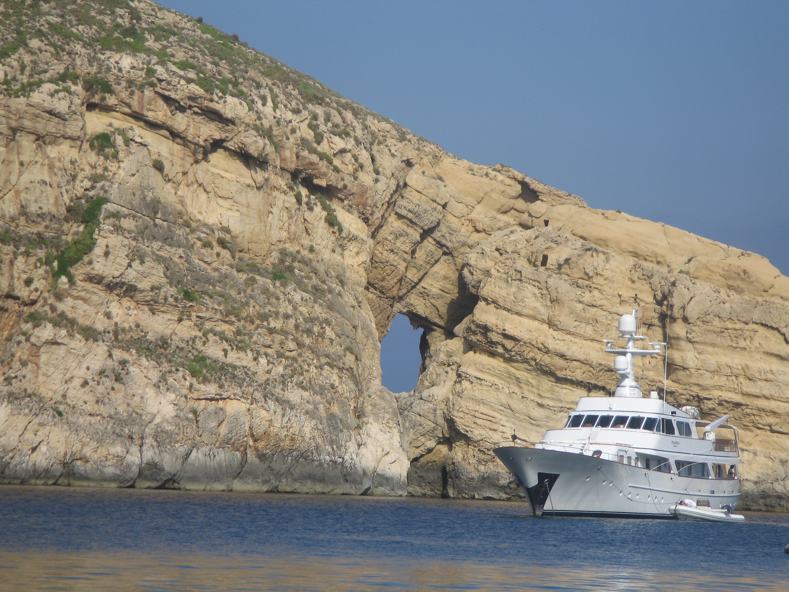
Malta is a truly unique territory, boasting an exceptionally rich cultural and historical heritage, shaped by the passage of countless peoples and civilisations throughout the centuries, attracted by its strategic location in the heart of the Mediterranean Sea and the natural harbours of its coasts, where, according to tradition, the Apostle Paul was shipwrecked on his way to Rome in 60 AD.
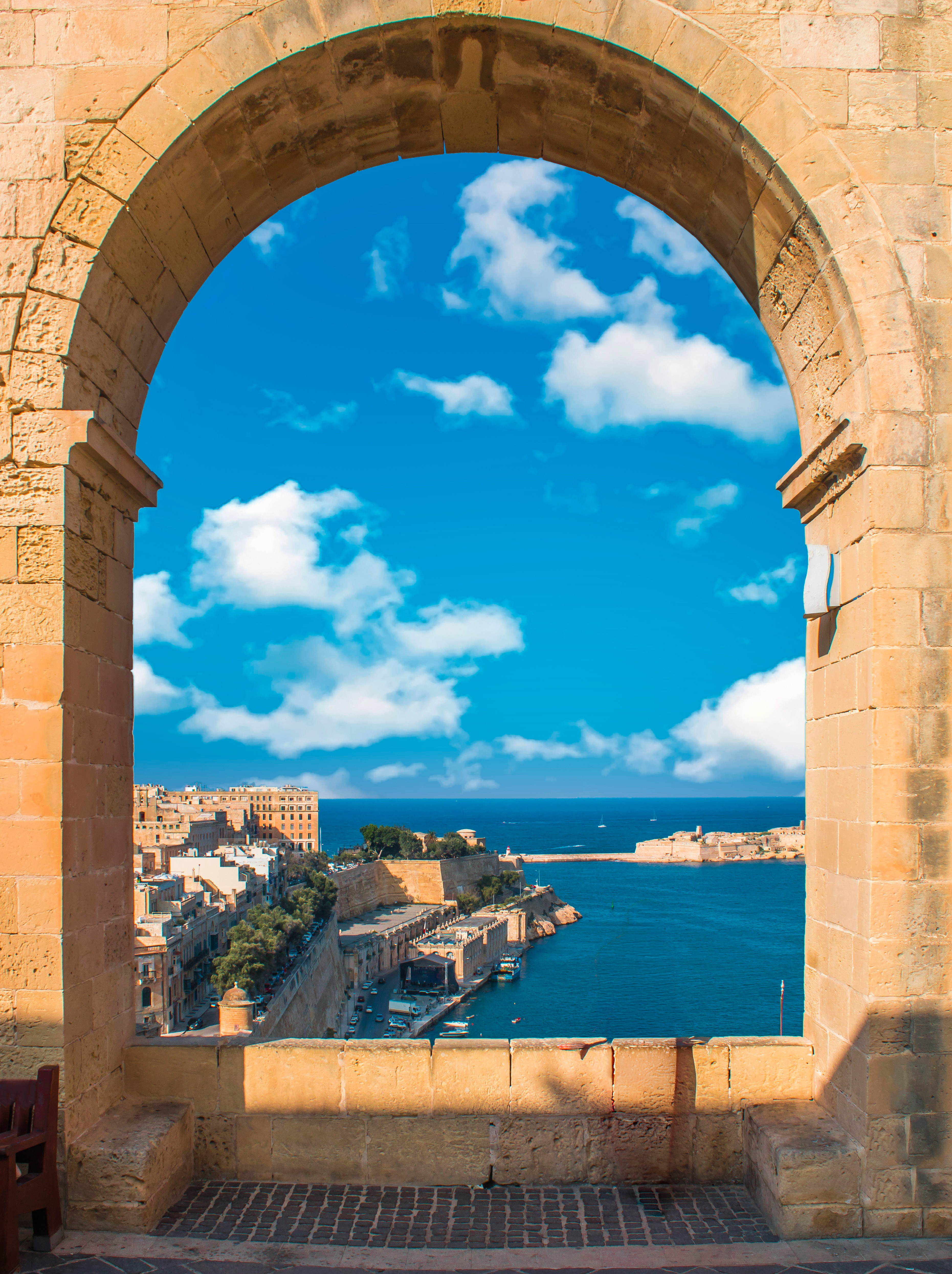
Home to the Knights of St. John (also known as the Order of Malta), since 1530, Phoenicians, Carthaginians, Romans, Ottomans, Normans and, later, British and Italians, have left their mark on this unique territory. Malta is home, for example, to the oldest standing buildings in the world, the megalithic temples of Ggantija in Gozo, dating from between 3,600 and 3,200 BC. They predate the Egyptian pyramids and are UNESCO World Heritage Sites, as is the national capital, Valletta.
Today, despite the limitations in natural resources associated with its island status and small size, Malta, a member of the European Union since 2004, has developed a dynamic, service-based economy, growing by around 4% in 2025, driven in particular by technology and financial services. It is also a popular tourist destination, having welcomed a record of over four million visitors last year, attracted by its cultural attractions and leisure activities, as well as its rich history and distinctive natural and built heritage.
Malta’s history is marked by significant challenges and defining conflicts, from the Great Siege of Malta to its heroic resistance during World War II. This resilience is symbolised by the George Cross, awarded to the nation for valour in 1942 by George VI and still borne on the national flag. Today, Malta faces very different challenges, but with the same spirit of determination.
One of the most important and complex challenges is achieving fluid and sustainable mobility in a very small island territory. Malta has the highest population density in the European Union (around 1,700 inhabitants per km²), among the highest globally, no motorways or rail network, and a long-standing, deeply ingrained reliance on private vehicles.
For more than a decade, Ineco has worked alongside Transport Malta, playing an active role in transforming and improving mobility across the islands. The most recent work is the update of the National Transport Model, first developed between 2014 and 2016. This is a simulation and analysis tool which, based on real data, forecasts the possible evolution of transport supply and demand in different scenarios, providing the necessary information to update, in turn, the measures and actions included in the Transport Master Plan, also drawn up by the company, together with the National Strategy, the roadmap for Maltese transport until 2060.
02
Sfida kbira għal gżira żgħira (A Big Challenge for a Small Island)
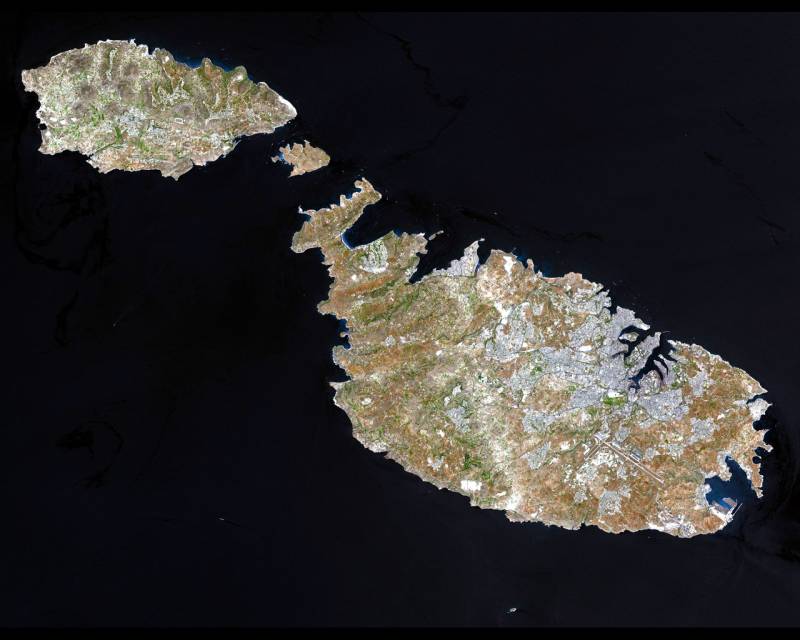
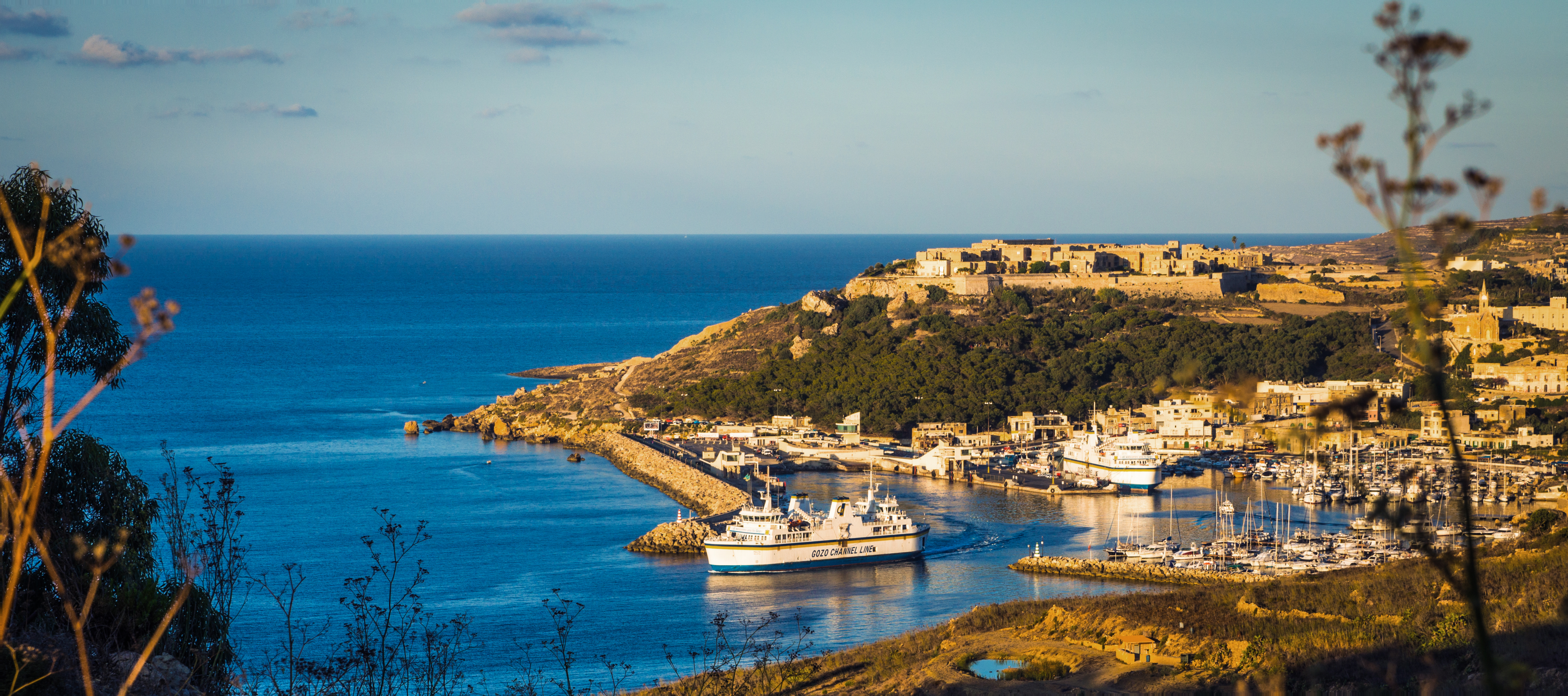
The archipelago of Malta is made up of several islets and five islands, of which only the three largest, Malta (where the capital, Valletta, is located) Gozo and Comino, are populated.
Ferry services (both conventional and fast) are vital for connectivity between the islands and with mainland Europe. Malta’s coastline includes a network of ports, harbours, and ferry landing sites, of which the most significant are the TEN-T Core Ports of Grand Harbour in Valletta and Malta Freeport in Marsaxlokk, as well as the TEN-T Comprehensive Port of Mġarr Harbour, which serves as Gozo’s main maritime gateway.
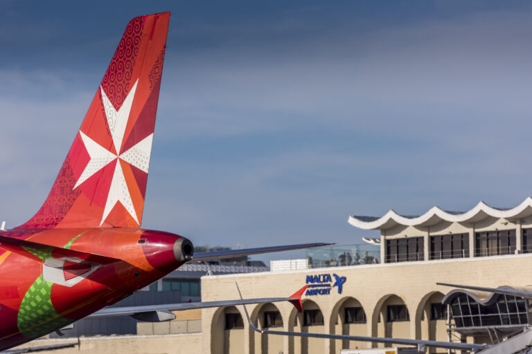
By air, Malta’s primary international connection is Malta International Airport, located in Luqa, southeast of the capital, which handled over 10 million passengers and 27,000 tonnes of cargo in 2025, and is currently undergoing a major expansion programme.
The main challenge for transport in Malta lies in land transport, given the country’s unique socio-demographic characteristics.
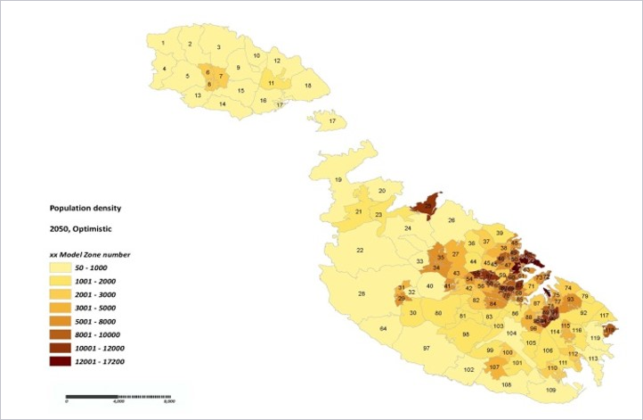
With a population of over 570,000 (as of end-2025, according to the National Statistics Office), combined with a significant number of tourists, all concentrated within just 316 km², Malta has the highest population density in Europe and one of the highest in the world.
At the same time, due to the small distances (with a maximum of about 27 km from north to south) there are no large capacity road or rail networks (although there was one between 1883 and 1931). This is compounded by the fact that workplaces, and with them commuting, are concentrated in a few locations, mainly around Valletta and the North and South Harbour areas.
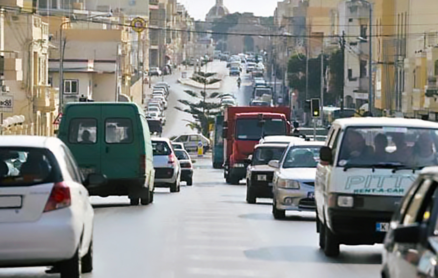
Hence, the private vehicle is the predominant mode on the two largest islands (as there are no cars on Comino) with a ratio of close to one per inhabitant: according to the NSO, as of December 2025, there were 457,403 motor vehicles registered, of which more than 46,600 were two-wheelers (motorbikes and others, such as scooters, electric bicycles, etc.).
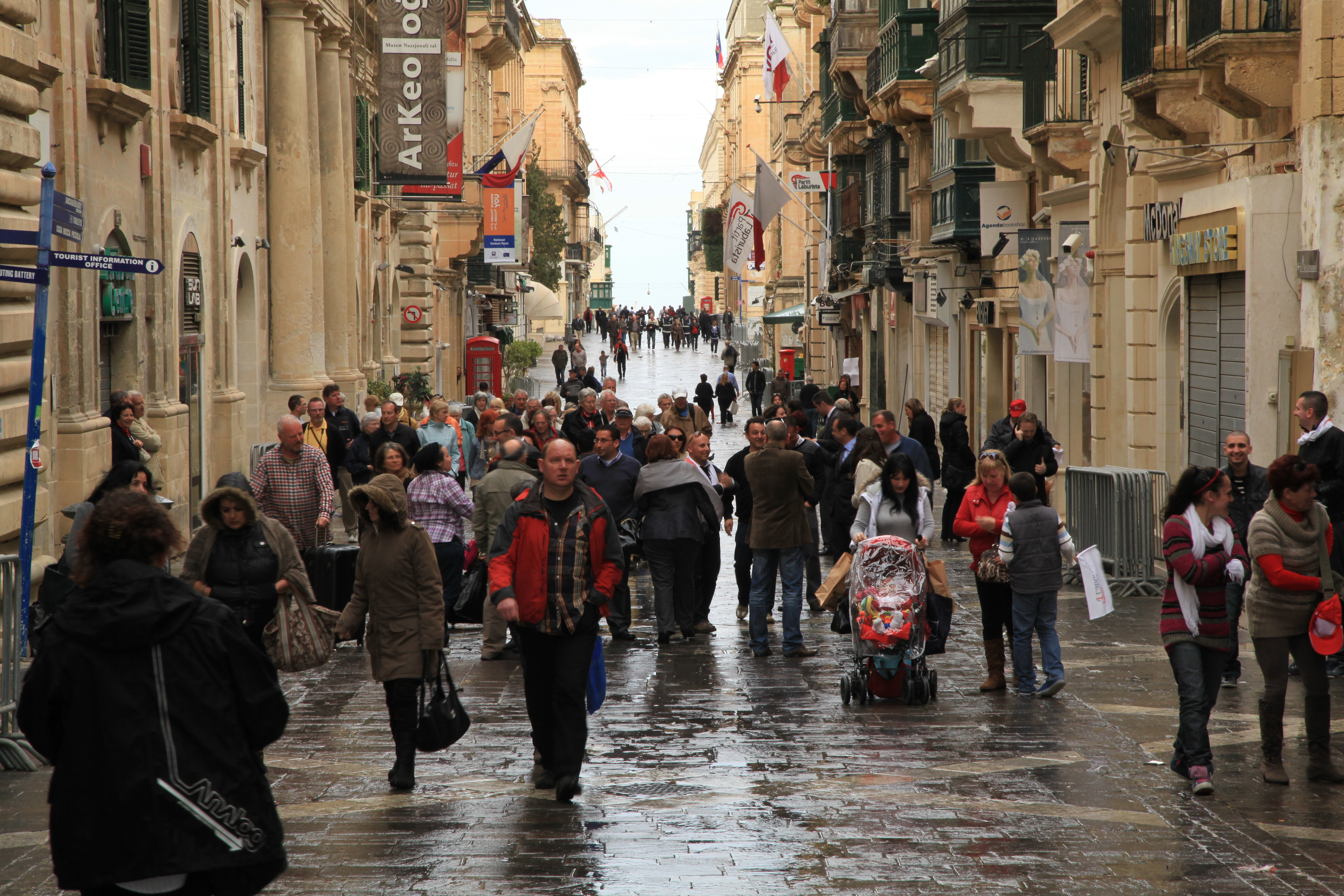
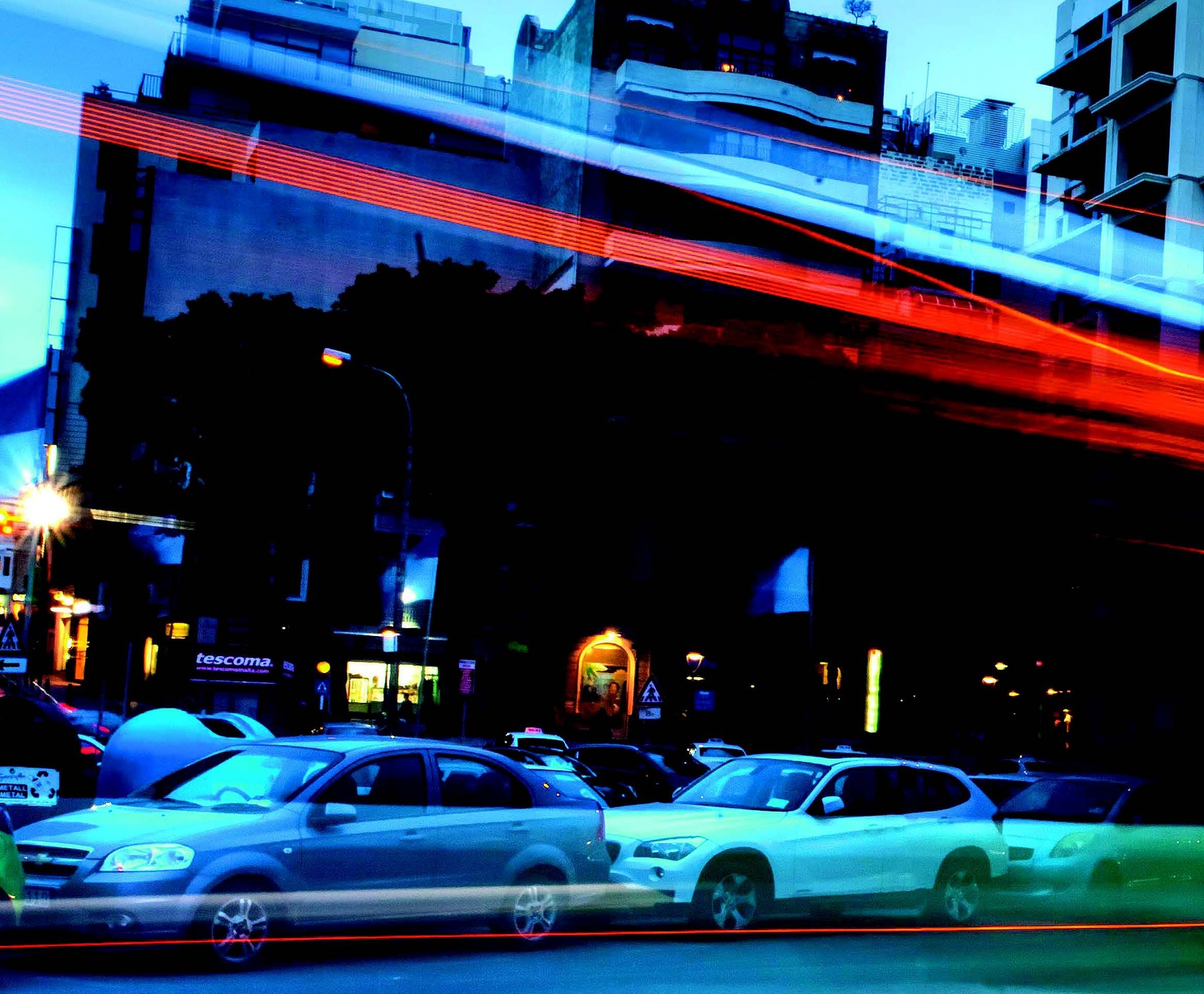
The prominence of the car translates into congestion on urban roads and at various points on the interurban network of just over 3,000 km, of which 2,700 km are paved roads and the rest roads.
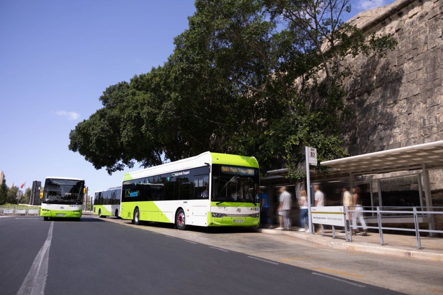
The Malta bus network has 127 lines, over 2000 stops and a fleet of 500 vehicles. Photo: Malta Public Transport
The public transport alternative is the bus network, currently comprising 127 lines and some 500 vehicles. The fleet, which has almost doubled in the last 10 years, is in the process of renewal and decarbonisation, with 32 all-electric, zero-emission buses to be introduced in 2024.
The Maltese land transport system is completed by a fleet of rental cars and bicycles, taxis, minicabs, minibuses, electric bicycles, and various tourist vehicles.
03
Direzzjoni Strateġika Ġdida (A New Strategic Direction)
In this context and following its accession to the European Union in 2004, Malta embarked on a profound process of reform and restructuring of its transport system, in order to make it more efficient and sustainable.
The new phase entailed institutional restructuring, with the creation of a single transport authority, Transport Malta, in January 2010. The new body centralised the functions and competences of all modes (land, sea and air) hitherto divided between other public bodies: the Maritime Authority, the former Land Transport Authority and the Civil Aviation Authority.
Among other initiatives, the new authority promoted a change in the approach to strategic transport planning in the country: comprehensive, multimodal and with a short, medium and long-term vision.
"The national vision guiding the formulation of this transport strategy is to provide a sustainable transport system that is efficient, inclusive, safe, secure, integrated and reliable for people and freight, and that supports attractive urban, rural and coastal environments and communities where people want to live and work, now and in the future”. National Transport Strategy 2050 (2016)
A vision that began to take concrete shape from 2014, when Transport Malta selected the international consortium led by Ineco, together with the Italian engineering firm Systematica, with the support of the Maltese firm ADI Associates, which was in charge of the strategic environmental assessment, to plan the future of transport in the country. Thus, the consortium elaborated a National Strategy until 2050 as a general framework and a Transport Master Plan with a 2025 horizon, which contained measures "in the form of policies, action plans or short-term measures".
Both documents were published in 2016. And all of this was supported by the information provided by a National Transport Model on a macroscopic scale, the first to be carried out in the 21st century, since the most recent known one was developed in the 1990s.
Given that the objective of any transport model is to facilitate decision-making by managers and operators based on the analysis of real data, the models must be updated, recalibrated and validated from time to time to integrate the relevant changes that have taken place, such as improvements in infrastructures, fare modifications, etc. In turn, strategies and action plans also need to be revised in order to adapt to the updated forecasts.
In the case of Malta, the national authority re-commissioned the Ineco-Systematica consortium to update the National Transport Model in 2018 and 2022, in turn supporting the update of the National Strategy to 2050 and Master Plan, which extended its time scope to 2030.

The Plan was also updated to analyse the impact on transport of social changes such as teleworking and e-commerce, as well as an analysis of measures implemented to date (58% of the 191 planned): improvement and rehabilitation works in road, port and airport infrastructure, in public transport (single ticket mobile application, improvements in bus stops, new free fast ferry services, among others), active mobility (improvements for pedestrians and cyclists), environmental (promotion of electromobility, new zero or low-emission buses), etc.
"The National Transport Master Plan 2030 (...) building on the foundations of Plan 2025, (...) integrates lessons learnt from previous initiatives and addresses evolving challenges to chart a comprehensive roadmap for Malta's transport future." Malta National Transport Plan 2030 (2022)
The most recent update of the Model was launched at the end of 2024 “with the objective to support Transport Malta in the implementation of new measures in the National Transport Model and to define new scenarios (...) which should result in a better cost-benefit ratio than those (...) already presented".
04
Ħarsa lejn il-futur (Looking to the Future)
A transport model is an analytical tool which, using specialised commercial software (in the case of Malta, Cube Voyager from Bentley Systems) reproduces the mobility patterns of both private traffic and public transport and generates forecasts of the evolution of the supply of public transport.
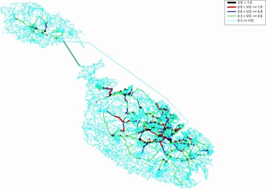
It generates forecasts of the evolution of supply and demand in the different transport modes, it allows the presentation of thematic maps illustrating the characteristics of the transport system, and simulates the possible effects of different measures and actions in different scenarios and time horizons. This provides decision-makers and planners with useful knowledge.
"The National Transport Model (...) allows the simulation and analysis of the urban and interurban transport network/system and its interactions with economic, social, environmental and urban planning factors (...) and is used to assess demand for transport services (...) and is used to assess future demand for passenger and freight transport by mode, in the short, medium and long term, taking into account the impact of economic and demographic trends over the period in each geographical area". Malta National Transport Model, 2025
There are many types of modelling and simulations, which can be carried out at different scales, from studying single elements (for example, a traffic light at a junction) to a large infrastructure- such as an airport or a highway- or a complete transport system, as in the case of Malta, which is called a macroscopic model.
The purpose of a model of this type is to obtain a global and multimodal vision at the level of an entire country, which is a highly complex task that requires professionals with experience and specialised knowledge, such as those at Ineco. It is a "four-stage" model, which refers to the methodological sequence followed to estimate transport demand: trip generation, distribution, modal split and allocation.
To build the model requires the selection of data sets of different types (not only transport, but also demographic, urban, economic, environmental, etc.) all referenced to the same year, called the base year; 2021 in the case of the latest update of the Malta National Model.
To obtain the demand forecasts, 2025 and 2030 have been defined as short- and medium-term forecast years. In addition, and only as a trend scenario, 2060 has been set as the long-term horizon.
On the supply side, two possible scenarios for infrastructure investments and sustainability measures have been established: business-as-usual (BAU) and do-something (DS).
The model analyses the different possibilities of interaction between these elements and generates results in the form of performance indicators and metrics, such as congestion costs, accident costs or environmental impact data.
An example of the model's capabilities is the analysis of the environmental impact of road transport. To estimate this, several factors are considered, including the composition of the vehicle fleet and its projected evolution, classified into light vehicles, heavy vehicles and buses; the type of propulsion (petrol, diesel or electric) and the associated fuel consumption; annual road traffic levels expressed as vehicles per kilometre; and the categories of pollutants involved.
A comparison of the values in the different scenarios shows that in the DS intervention scenario (do-something-2030) "the environmental impact is reduced compared to the BAU scenario due to the investments". The specific reductions for each type of pollutant (CO2, NOx, etc.) are also detailed. The conclusion is that if the projections for electromobility and an increase in the modal share of public transport are met, the intervention scenario (DS) 2030 would achieve "slightly better emission levels than those obtained in the non-intervention scenario (BAU) 2025"
The model also includes a cost-benefit analysis, which is carried out by assigning a monetary value to transport impacts, which allows estimating whether the benefits associated with the actions offset the opportunity cost of the resources required to implement and operate a project.
Accordingly, the analysis has examined both the volume and value of time lost due to congestion, levels of pollutant emissions and economic costs arising from road accidents (including medical costs, vehicle repair, lost productivity and property damage). For example, in the latter case, the model shows that by 2030 accident-related costs would be lower under the intervention scenario (DS) than under the non-intervention scenario.
Ultimately, the Model is a tool that Malta has at its disposal to wage, once again in its long history, a decisive battle: that of sustainable mobility. In this case, however, the weapons are neither cannons nor aircraft, but the knowledge and technology of the 21st century.

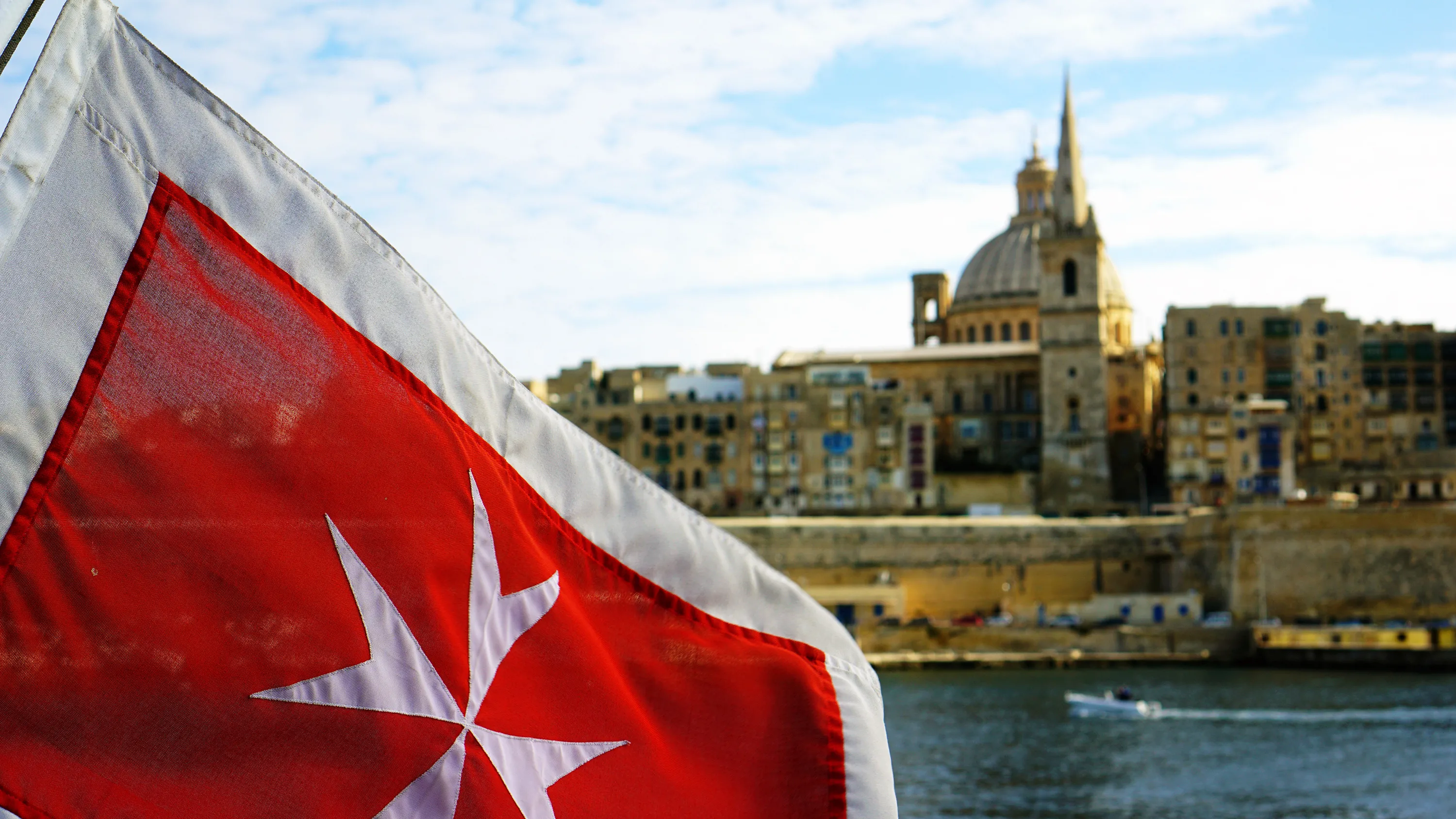
National flag of Malta, with the Cross of Valour awarded by King George VI to all Maltese for their defence of the country during World War II. Photo credit: Wikipedia CC- Christian Launer
Allies in sustainable mobility
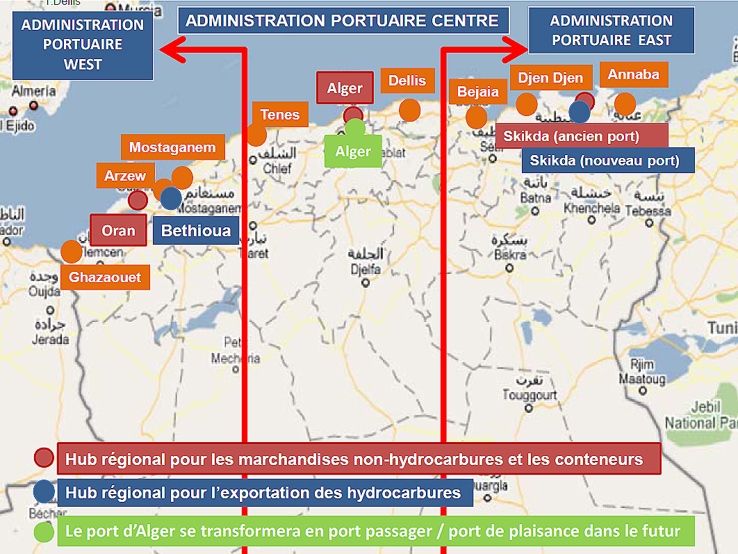
Algeria's port structure, contained in the National Transport Plan drawn up in 2011 by a consortium led by Ineco. More than 3,000 km of railway lines and more than 23,700 km of roads and motorways were modelled in order to forecast passenger and freight transport demand up to 2025.
Ineco, from its beginnings to the present day, has extensive experience of more than 55 years in transport planning at national level, and has participated in all the major Spanish national plans and strategies, including the current Safe, Sustainable and Connected Mobility Strategy 2030, as well as collaborating in the drafting of the recently approved Sustainable Mobility Law.
The company has also developed several studies and plans at regional and local level, such as the sustainable urban mobility plans for Spanish cities like A Coruña, La Rioja or L'Hospitalet de Llobregat.
In the international context, in recent years it has developed national transport plans for countries such as Costa Rica, Ecuador and Algeria, as well as the National Transport Model for Croatia, and sectoral plans including the Strategic Bus Transport Plan for Oman, the Railway Transport Plan for Kuwait, and the Transport and Traffic Master Plan for the Rabat–Salé–Temara metropolitan area in Morocco.


