Ineco has strengthened its position as a benchmark in methodological innovation in the transport sector with the publication, in the international scientific journal Transportation Research Part A: Policy and Practice, of a study authored by transport economics and policy experts Federico Collado and José Ángel F. Gago.
The article introduces the Relative Territorial Metropolisation Index (RIMT), a new metric developed by Ineco to objectively quantify how roads, railway lines, or advanced transport systems enhance connectivity between cities and regions, enabling them to function in a more integrated way.
An Index to Measure Functional Compactness
Every improvement in a transport network—such as a new motorway or high-speed rail line—reduces functional distances between cities. While the physical map remains unchanged, the time required to travel does not, and this reduction profoundly alters how people, businesses, and services interact.
This process, known as metropolisation, means that previously fragmented territories begin to operate as a single, more cohesive and connected system. People can more easily live in one city and work in another, businesses expand their area of influence, and opportunities for economic and social exchange increase. However, despite being widely recognised in both academic and professional spheres, there has to date been no precise tool to measure this phenomenon in a systematic and comparable way.
The new index developed by Ineco is based on travel times between different points in a territory and on geometric techniques applied through geographic information systems (GIS). Using these data, the RIMT quantifies how much a territory becomes “compressed” thanks to a transport infrastructure. In simple terms, it measures the degree to which a territory contracts as its connectivity improves. It is an objective, replicable tool, free from the biases of subjective parameters, facilitating its practical use in real-world projects.
International Validation
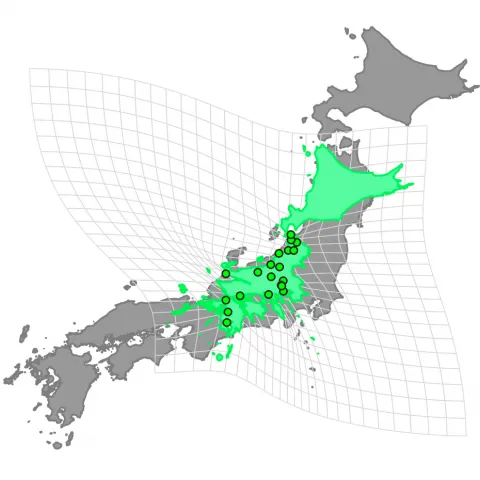
To validate its usefulness, the index has been applied to four international case studies: the road network of southern Michigan in the United States; the Haramain high-speed line (“Mecca–Medina”) in Saudi Arabia; the Shinkansen (“bullet train”) network in Japan; and a prospective Hyperloop network in Europe. The results reveal highly significant theoretical reductions in the effective surface area of the connected territory, ranging from 72% to 98%. This means that, thanks to transport improvements, a territory may function as if it were far more compact than its physical size would suggest. These findings are aligned with Tobler’s First Law of Geography, which states that the closer two places are in practical terms, the stronger their interactions.
A Strategic Tool for Decision-Making
Beyond academic analysis, the RIMT is intended as a strategic tool for planning and decision-making. Its application makes it possible to assess the territorial impact of new infrastructures, reinforce the technical justification of strategic projects, and complement traditional socio-economic impact assessments.
The index developed by Ineco offers a rigorous and accessible way to address a key question for public administrations, planners, and investors: how and to what extent transport transforms a territory and what development potential it generates. The company has already applied an adapted version of this index in a project for Adif in Jerez de la Frontera.
With this contribution, Ineco reinforces its position as a leader in methodological innovation in the transport sector, combining scientific research and practical application to support improved territorial planning.